
İstanbul metro map
The whole network on one map — 11 metro lines and 158 stations. Download the map as a PNG or PDF below.
İstanbul metro lines map
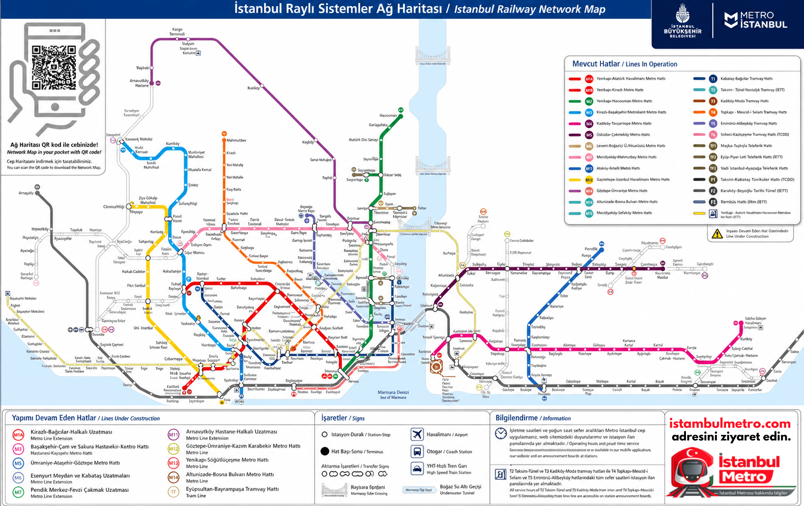
The map shows the metro lines as well as Marmaray, tram, Metrobüs and funicular lines. Check metro.istanbul for the latest official map. Source: Metro İstanbul A.Ş. / İBB official network map.
Lines and their colours
Interchange hubs
At interchange hubs you switch between lines through internal passages or short walks — with İstanbulkart, transfers within 90 minutes are discounted. İstanbul’s busiest interchanges are Yenikapı, Gayrettepe, Ayrılık Çeşmesi and Üsküdar.
Frequently asked questions
The network has 158 metro stations and 11 lines — a rail network of about 265 km. Marmaray, tram and Metrobüs lines also appear on the map.
Right here on this page — click the “Map PDF” button and the file is saved to your device. The map is also available as a PNG. Both are free, printable and can be used offline.
Yenikapı is the largest hub, where M1, M2 and Marmaray meet. Other major interchanges are Gayrettepe (M2+M11), Ayrılık Çeşmesi (M4+Marmaray), Üsküdar (M5+Marmaray) and Mahmutbey (M3+M7).
The map is a current network diagram that includes M11’s İstanbul Airport and Halkalı connections and the M9, M4 and M5 extensions. For new openings, check metro.istanbul before you travel.